


Le pègue 1

raygautier
User

Length
13.6 km

Max alt
728 m

Uphill gradient
608 m
Km-Effort
22 km

Min alt
357 m

Downhill gradient
607 m
Boucle
Yes
Creation date :
2023-03-16 08:37:28.0
Updated on :
2023-03-17 09:31:33.293
6h28
Difficulty : Very difficult

FREE GPS app for hiking
 SityTrail
IGN / Geographical institutes
SityTrail Plus
The world is yours!
About
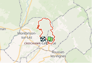
Trail Walking of 13.6 km to be discovered at Auvergne-Rhône-Alpes, Drôme, Le Pègue. This trail is proposed by raygautier.
Photos

Positioning
Country:
France
Region :
Auvergne-Rhône-Alpes
Department/Province :
Drôme
Municipality :
Le Pègue
Location:
Unknown
Start:(Dec)
Start:(UTM)
662855 ; 4921461 (31T) N.
Comments